


A Revolution in the World of 3D Surveying: How the Eagle Pro LiDAR Device Transformed Our Operations and Specialized Training
A Revolution in the World of 3D Surveying: How the Eagle Pro LiDAR Device Transformed Our Operations and Specialized Training
In a rapidly evolving technological landscape, the need for more accurate and faster surveying solutions has become indispensable. In response, our company has incorporated the 3DMakerpro Eagle LiDAR Scanner into its workflow, offering a new level of professionalism in 3D surveying, backed by extensive experience and advanced training programs.
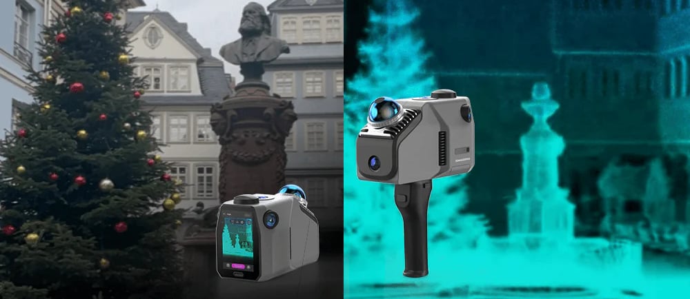
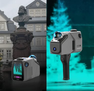
What is the Eagle LiDAR Device?
The Eagle LiDAR is a handheld 3D scanner that utilizes modern LiDAR technology. It is distinguished by its exceptional ability to capture fine details of surfaces, buildings, architectural landmarks, and natural sites, producing high-quality 3D models.
Key Features of the Device:
Lightweight and easy to carry
Significantly faster scanning compared to traditional methods
Measurement accuracy reaching the millimeter level
Operates under various lighting conditions, including complete darkness
Compatible with point cloud processing software and BIM applications
Our Real-World Applications with the Device:
We have employed the Eagle LiDAR in several specialized projects, including:
3D scanning of heritage buildings while preserving architectural details with high accuracy
Comprehensive site surveys for construction areas, providing ready-to-use models for engineers and designers
Real-time documentation of construction progress using live point clouds
Accurate detection of topographic variations in complex terrain
The field results have been highly promising, enabling us to reduce execution time by more than 60% and significantly improve report quality.
Specialized Training: Our True Strength
We go beyond providing the device—we offer a pioneering specialized training program, the first of its kind in Egypt, which includes:
Practical, on-site training on how to operate the device
How to convert point clouds into ready 3D models
Integrating data with BIM models and topographic maps
Handling site challenges and performing data analysis
The program is available for students, engineers, and companies aiming to elevate their operations.
Why Choose Us?
Real field expertise in using the device
Practical training based on real projects
Ongoing technical support
Documentation and analysis at every step to ensure the highest quality
In Conclusion:
We do not simply sell a device—we provide you with a powerful technology that enhances the accuracy of your work, speeds up execution, and elevates the professionalism of your results.
Join us and be among the first to adopt the next generation of smart surveying technologies in Egypt and the Arab world.
Our Services
Contact
Sales
© 2025. All rights reserved.
We provide surveying solutions
MSI Training Academy
World-class engineering training