


MSI Academy for Training
MSI Academy for Training is one of the key pillars for developing competencies in the fields of surveying and engineering. Our goal is to prepare a generation of professionals specialized in land surveying, civil engineering, and engineering software, through advanced training programs designed to equip students, graduates, and professionals with the skills they need to succeed in competitive work environments.
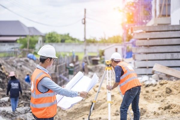
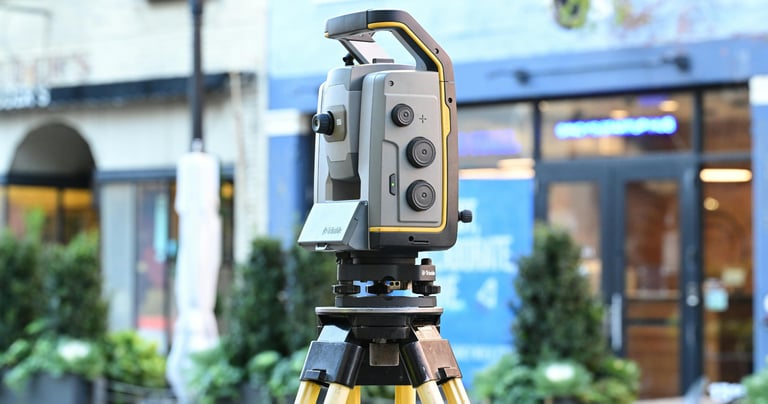
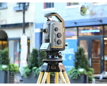
We offer accredited hands-on training in a range of advanced fields such as topographic surveying, map design, engineering project management, and the use of the latest surveying technologies and equipment like Total Stations, GPS Systems, and 3D Laser Scanners. We also provide training on advanced engineering software such as AutoCAD, Civil 3D, Revit, 3ds Max, Google Earth, and ArcGIS.
All of our programs include the latest versions certified by the manufacturers, ensuring 100% original software for guaranteed quality training and precise performance.
We bring our field expertise directly to the classroom under the leadership of Eng. Adel Omar, who possesses over 15 years of experience in state-of-the-art GNSS systems and our pioneering work in 3D Scanning and LiDAR technologies.
Our training courses are available to all students in Egyptian universities and institutes specializing in engineering and surveying, as well as graduates and professionals looking to improve their technical and scientific skills to achieve leadership positions in their respective sectors. Through our academy, we open doors to professional excellence and unlimited opportunities for advancing your career.
Diploma in Advanced Engineering Surveying
The Advanced Engineering Surveying Diploma aims to provide participants with in-depth knowledge and specialized skills in three main areas: structural engineering surveying, road and utilities surveying, and infrastructure surveying. This diploma is designed to enhance the capabilities of professionals in handling advanced engineering projects and provides training on the latest technologies and equipment in the field.
Diploma in Integrated Surveying
A comprehensive diploma designed to train participants on all aspects of surveying work. It covers topographic surveying techniques, land surveying, and the use of the latest equipment such as Total Stations and GPS Systems. In addition, the program includes training on advanced engineering software like AutoCAD and Civil 3D. This hands-on course is aimed at equipping participants with the essential skills needed to work efficiently in the engineering and surveying field.


Advanced Engineering Software Course
This course is designed to equip participants with the skills to use the latest specialized engineering software in the fields of surveying and civil engineering. It covers a range of advanced software such as AutoCAD, Civil 3D, Revit, 3ds Max, and Google Earth, as well as programs for integrating devices with engineering software. Trainees will be trained on the latest original versions of these programs, enabling them to complete their projects with high efficiency and precision, and preparing them to work in advanced work environments.
Integrated Surveying Equipment Course
A specialized training course aimed at teaching trainees how to use the latest surveying equipment available in the market. The course covers the operation of Total Stations, GPS, 3D Laser Scanners, Level, and Laser Level, as well as training on software integration between devices and engineering programs like AutoCAD and Civil 3D. The course emphasizes practical applications of the equipment in various engineering projects, equipping trainees with the necessary skills to ensure accuracy and effective execution of surveying tasks on the ground.


Advanced GIS Applications Course
This professional training program is designed to equip participants with the skills to use Geographic Information Systems (GIS) for precise and efficient spatial data analysis and management. The course includes training on creating digital maps, building geographic databases, and conducting spatial analyses to support engineering, surveying, urban planning, and environmental projects. Participants will learn to use the latest internationally recognized GIS tools and technologies to enhance the effectiveness and accuracy of their work.
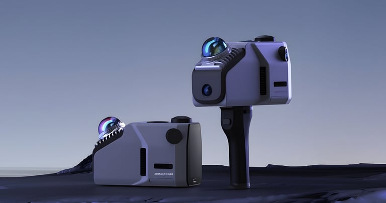
Advanced 3D LiDAR Scanning Course
This specialized course is designed to train participants in the advanced techniques of 3D LiDAR scanning, one of the latest technologies in geographic surveying. The course covers how to use LiDAR devices to create precise 3D models of infrastructure, terrain, and complex areas. It also includes training on how to process the collected data using specialized software to convert field scans into accurate maps and detailed analyses. This course aims to provide participants with the skills needed to implement LiDAR technology effectively in various surveying and engineering projects.


Our Services
Contact
Sales
© 2025. All rights reserved.
We provide surveying solutions
MSI Training Academy
World-class engineering training